Pictures from Col des Thuilles (2376m), la Gimette
Vallée de l'Ubaye, Alpes de Haute Provence, Southern France
© Copyright (2001) by nilum.com
|
"Capitalism operates to the benefit of all those who choose to be active
in the productive process, whatever their level of ability. But it is not
geared to the demands of stagnation. Neither is reality."
Quote from Ayn Rand's in
"The Virtue of Selfishness"
|
Pictures from Col des Thuilles (2376m), la Gimette,
Les Thuilles, Ubaye Valley, Alpes de Haute Provence, Southern France,
in fall 1999 from the road crossing (1300m) below the crete de Gimette
to Col des Thuilles (2376m), denivelée 1100m,
and May 2001 to Clot du Roi (1972m), denivelée 700m - photographer moi-meme.
This page is part of the mountain forest protection campain (MFPC).
The new nasty road which cuts through the very steep hill at the north face
of La Gimette was constructed between fall 2000 and spring 2001,
crosses the previously untouched and beautiful hiking trail twice.
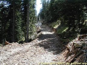
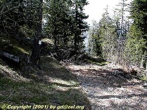
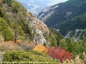
Even in summer when it's very hot, this trail is very recommended, because
the trees protect you against the sun while you mounts the uncountable
switch-backs.
But they cut the trees faster than I can take the photos.
I estimate, that the new road currently stops at elevation 1600m,
but there are already signs on trees above that point,
which most probably indicate its continuation in direction Clot du Roi (1972m).
(See photo, no. 21 and description below.)
Photo no. 5
below shows a (hopefully) finished clear-cut at the inner west face
at the entry of the Gimette valley.
The Gimette mountain is even steeper than the Peyron mountain, which is in the neighor
community; see another mountain forest currently under destruction
by the construction of a tax-payer subsidized road in the community of
Méolans-Revel,
My experience shows, that
the municipalities will not be able to maintain these roads.
The roads are constructed to cut and transport the trees to sell the wood.
Does this desserted alpine forest really merit to be destroyed by subsidies?
As explained in the Méolans-Revel page, cutting the trees would
not be profitable, if the roads were not subsidized.
Click on the images to enlarge:
|
Maybe it helps to write a letter (LRAR)
to the major of Les Thuiles and protest
about the Gimette forest road construction.
(It doesn't matter in what language you write,
because my experience shows that protest letters hardly get any reply.
So language is not important; so don't be disappointed, because I guess it is likely,
that they express their disdain with their unresponsiveness.)
|
| "Today there is an especially virulent form of corruption induced by overly rigid
systems. This new corruption, in service to the 'system's imperative,' is nonresponsiveness
to constitutent needs. A second form of corruption is the shocking waste of time and talent
poured into beating the system." Quote from Tom Peters, "Thriving on Chaos"
|
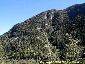
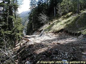
The new road starts cutting left at the north face of the Gimette.
|
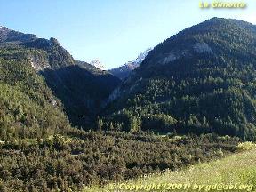
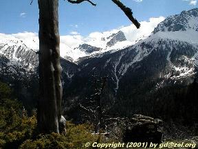
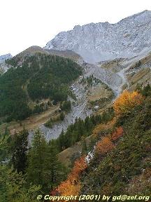
The Gimette valley with the Grand Seolane
|
|
|
|
|
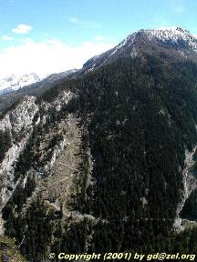
No. 5: Another (hopefully) finished clear-cut at the inner west face at the entry of the Gimette valley.
|
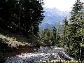
Col des Thuilles (2376m), photo taken from Clot du Roi (1972m) sur la crête de la Gimette, in May 2001.
|
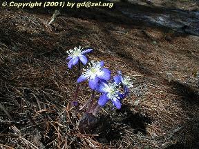
Vu 13-May-2001 à coté du sentier a la Gimette
|
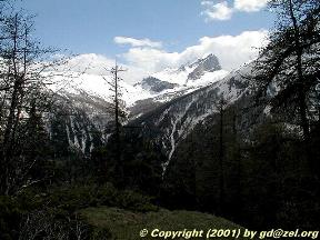
La Grande Séolane
|
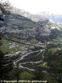
Les Thuilles village
|
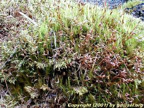
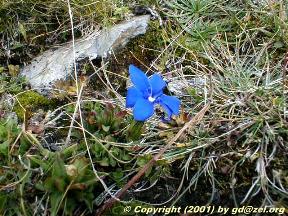
Flora: noli-me-tangere
|
|
|

|
|
|

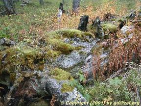
strange stone structures at the Grande Seolane
|
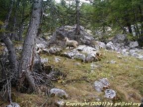
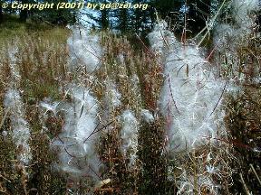
Fauna: "one sheep, two sheep, blue sheep, black sheep"
|
|
|
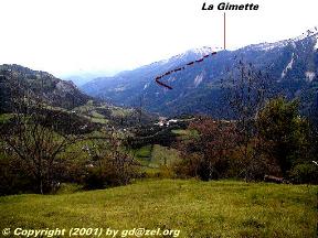
No. 21: The solid red line drawn just above the new road shows its first part. The
road then continues on the back side of the Gimette in two switch backs,
marked dashed-dotted. From seeing the marked trees, I guess,
that the road will later be continued to the height indicated by the dashed red line.
(The photo was taken from Meolans-Revel).
|
Links
Internal Links
www.nilum.com Home
External Links
 Mountain Picture Webring (MPR) Navigator
Any constructive comments, corrections, additions, and ammendments are welcome!
The URL of this page page is www.nilum.com/gimette
Copyright © (2000-2001) text and all images by www.nilum.com.
Pictures published with authorization.


